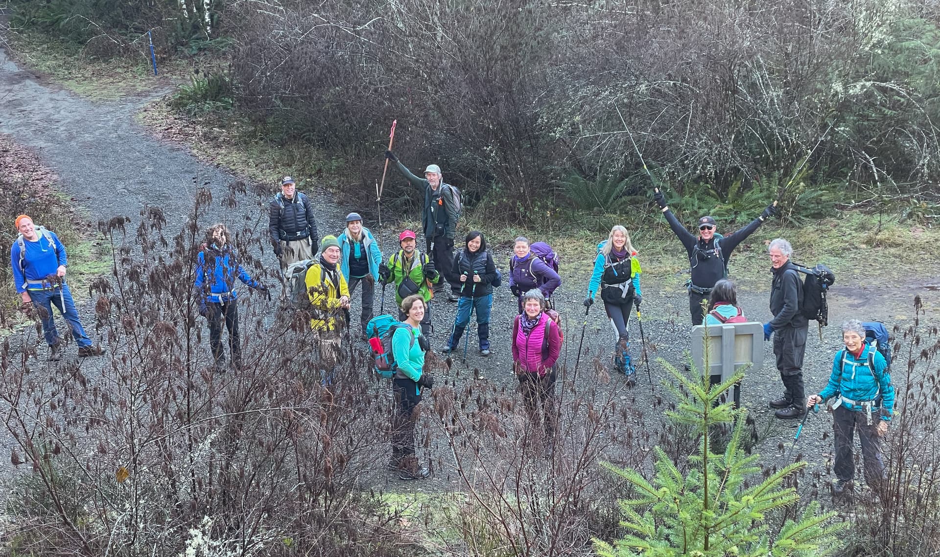
On Sunday Dec 19 Erich and Catrin led a happy crew of “Salubrious Solstice Steppers” out on a hike to welcome the Winter Solstice and the return of the light. This has become something of an annual event with everyone especially happy to get out this year as the 2020 hike was cancelled due to COVID.
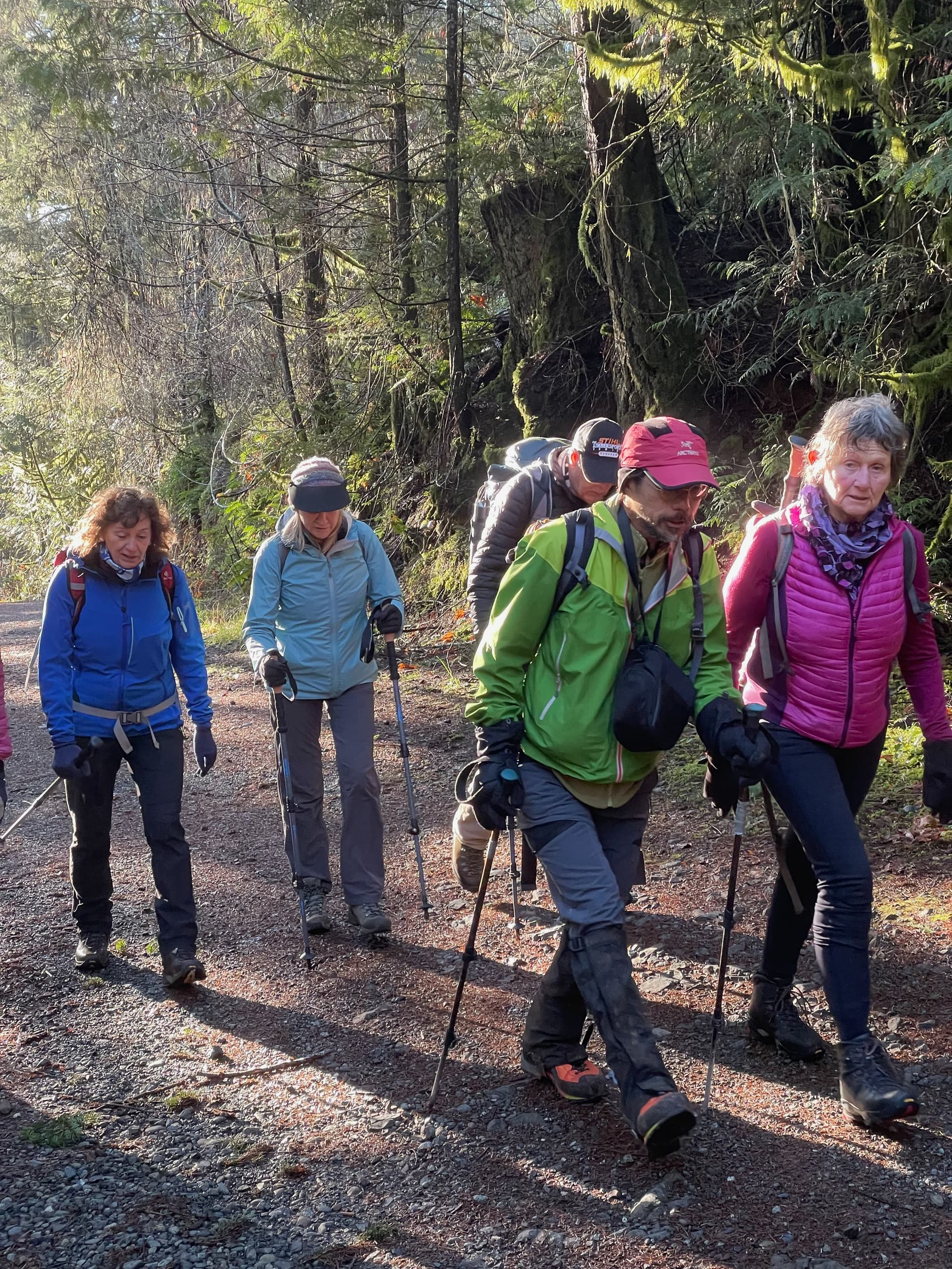
We were 17 in total and our route was the traditional one: Begin at Harbourview Road in the Sooke Hills, up Mt. Brulé for tea, down to the Kinnikinnick Trail, and then ascend Mt. Quimper via the classic FM-Radio route. Descent from Quimper is via minor modifications to the main south side Summit Trail.
]
Given that Saturday 18 was so wet (yours truly was out that day for the Victoria Christmas Bird Count on Scafe Hill in unrelenting rain) I was a bit concerned that the weather would dampen our Sunday. But, Erich must have appropriately propitiated the weather goddess because we had an absolutely stunning day. Not 10 minutes into the hike and everyone was shedding layers.
Our first stop was Mt. Brulé via the Rocky Ridge Trail. At 378 m Brulé is not particularly tall, but, it does command outstanding views to the southeast: Sooke Basin, the ridgeline of East Sooke Park, the hills below Glintz Lake, and glimpses of the Salish Sea in the distance have this little hill punching above its weight when it comes to scenery.
From Brulé it was down and along the Kinnikinnick Trail. Sure, we could have used Sooke Mountain Trail – aka Harbourview Road. As Ken said more than once “it would have been faster”, but where’s the fun in that! At the end of Kinnikinnick we back-tracked a few metres and joined the FM-Radio trail up the NW flank of Quimper.
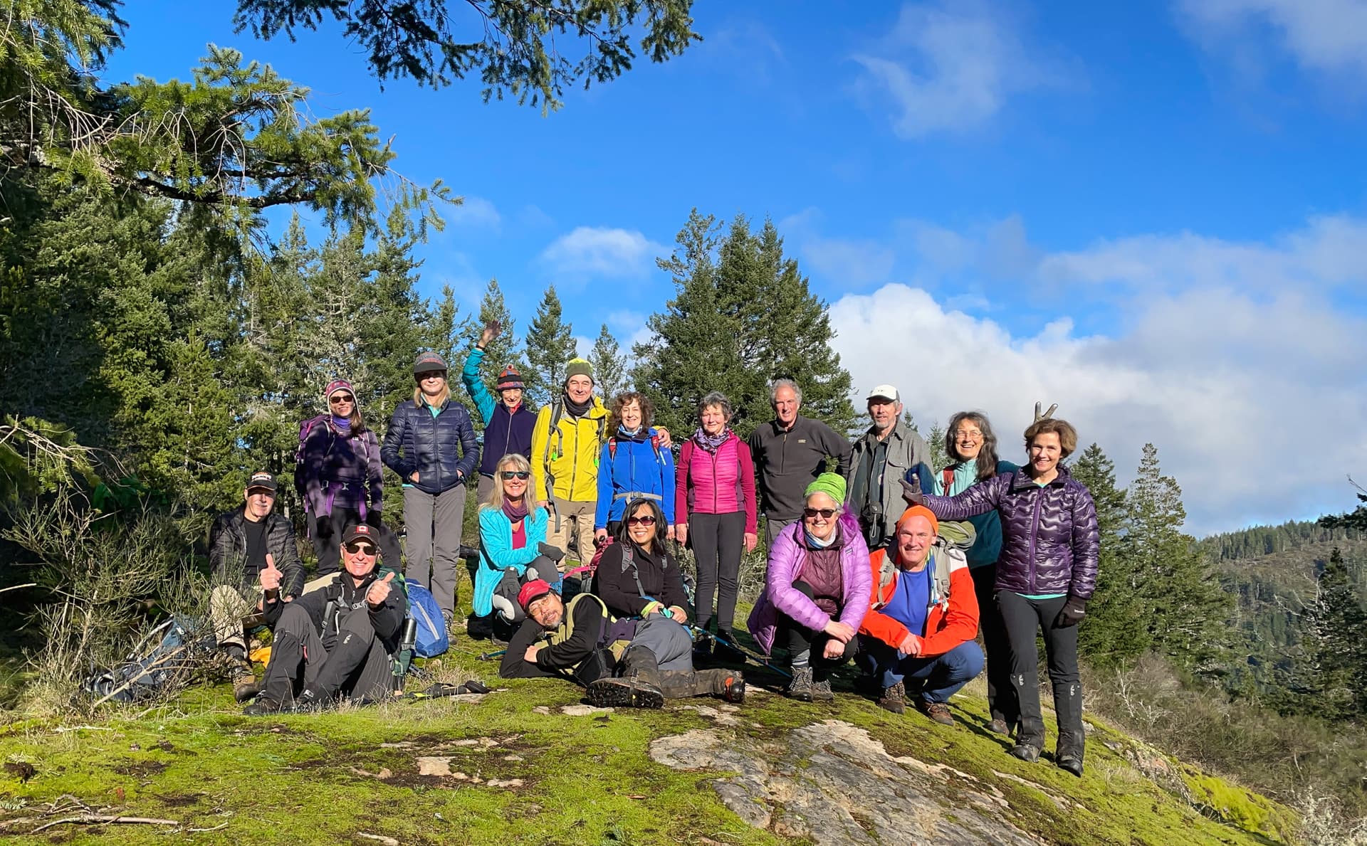
By 2:00 PM everyone was gathered on the summit of Mt. Manuel Quimper. The sun was warm, but a cool wind and some “atmospheric” clouds meant we didn’t lounge quite as much as we might have earlier in the day. Still, everyone made the most of Quimper’s 546 metre height to take in expansive views, especially to the east, south, and west.

By about 2:30 almost everyone but the most diehard summit loungers (that would be Margaret, Ian, and Erich) started down. Anyone who has spent any time on Quimper knows the place is a veritable warren of trails. But, on the south side of the mountain if you let the Quimper Summit Trail be your touchstone you’ll make it back to the parking lot – eventually.
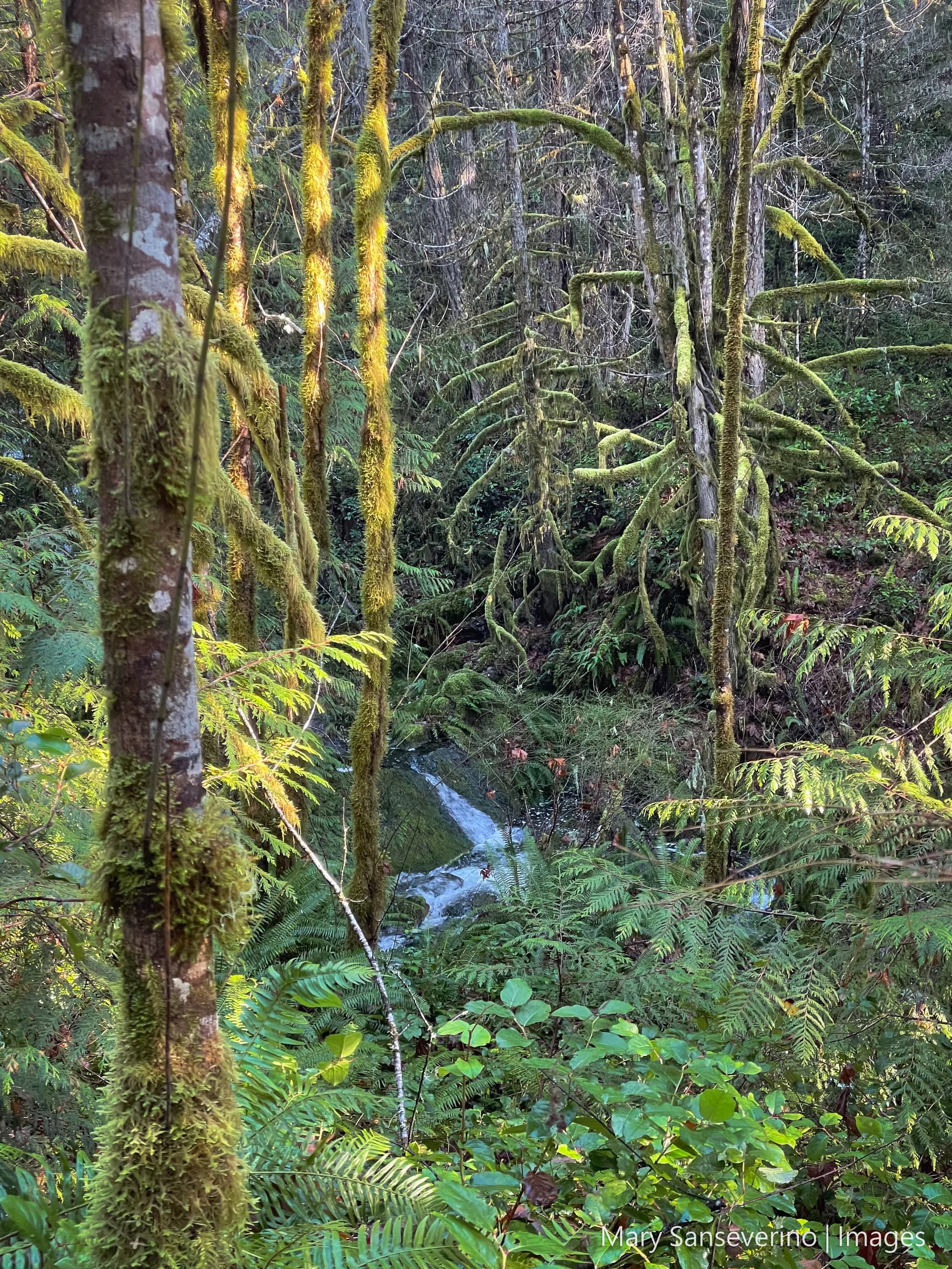
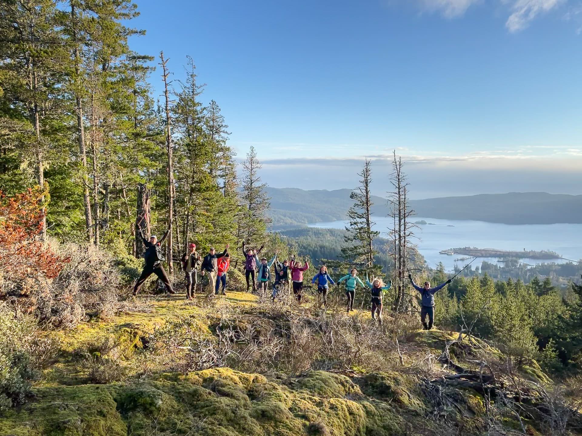
However, don’t be too slavish about staying right on the Summit Trail – there are lots of beautiful views to be found on side/alternate trails, especially in the glowing late afternoon light around the Winter Solstice. One such spot, on a ridge route just west of the Summit Trail, had the Solstice Steppers jumping for joy.
The team were all gathered back at the Harbourview lot by 4:15 PM. We said our goodbyes and wished one another a Salubrious Solstice, Merry Christmas, and Happy Holidays. Everyone passed on an extra special holiday thank you to Erich and Catrin for organizing a fine hike with glad company on a grand day.
No one really knows what 2022 has in store for us, but I, for one, am going to spend as much of it as I can outdoors tramping around Vancouver Island’s mountains and hills. And I, like many others I could name, will count myself blessed to have such beauty to wander in.
Happy Trails to us all in the New Year!
Submitted by Mary Sanseverino - one of the 2021 Salubrious Solstice Steppers.
Trip Details
Distance: ~12 km
Ascent: ~625 m
Time: ~6.5 hrs
Leader: Erich Schellhammer
Link to route map and description (Gaia - but open to all)
Link to GPX and KML files of the route
Link to lots more photos on Mary’s Flickr pages