On a previous ACCVI trip with the same objective, we only made it to the start of the route at the low point of the ridge just to the northwest of Mt Service. This was on May 1st and large amounts of deep and soft snow covered much of the trail, which made for challenging conditions and slow progress on snow shoes.
On this second trip, June 25-26, conditions were dramatically different, with summer well underway. Although we carried snow shoes, we never actually used them. My 2 companions (Catrin and Adriana) are very fit and experienced outdoor people, but with different backgrounds - it was the first bushwhacking experience and Canadian mountain trip for Adriana, who has been visiting British Columbia from Germany.
We started the 2-day trip on Saturday afternoon by hiking from the trailhead to the Cottonwood Creek crossing, about 6 km from the trailhead. This was followed by a creek-side dinner conversation and a quiet night. We were back in our boots at 7:00 am on Sunday, looking forward to the summit, despite the fact that we all started the day with somewhat low energy levels. Only Adriana had remembered to bring coffee for breakfast, enough for about one cup, which she kindly shared with everyone else.
The trail from the camp quickly changed from a steady and easy gravel road hike to a moderate slide alder whack higher up. This was then followed by a more pleasant hike in the old growth forest closer to the top of the ridge.
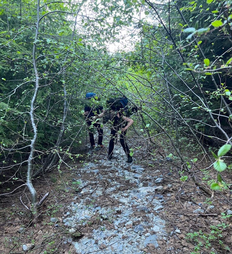
Bushwhacking (photo credit: Catrin)
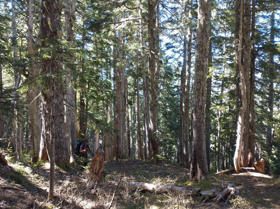
Old growth section
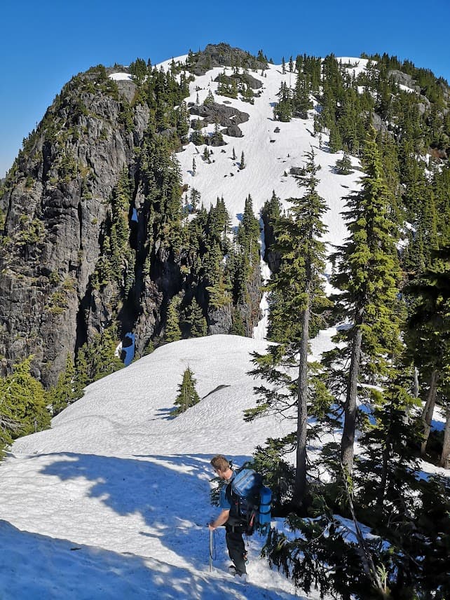
We reached the first high point on the ridge about 3.5 hours after leaving camp. Once on the ridge, we took plenty of time to enjoy the great views. The weather was pleasantly warm, sunny, and calm - ideal weather conditions for hiking and lounging on the ridge. We were not in a rush when we approached the base of Mt Service from the northwest at about 12:30 pm. A plan was made to follow a line on the climbers’ right to try to avoid much of the rotten-looking snow, but still staying as close as possible to the ridge line.

Finally up on the ridge, looking down towards Jump Lake
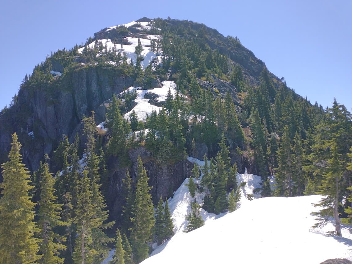
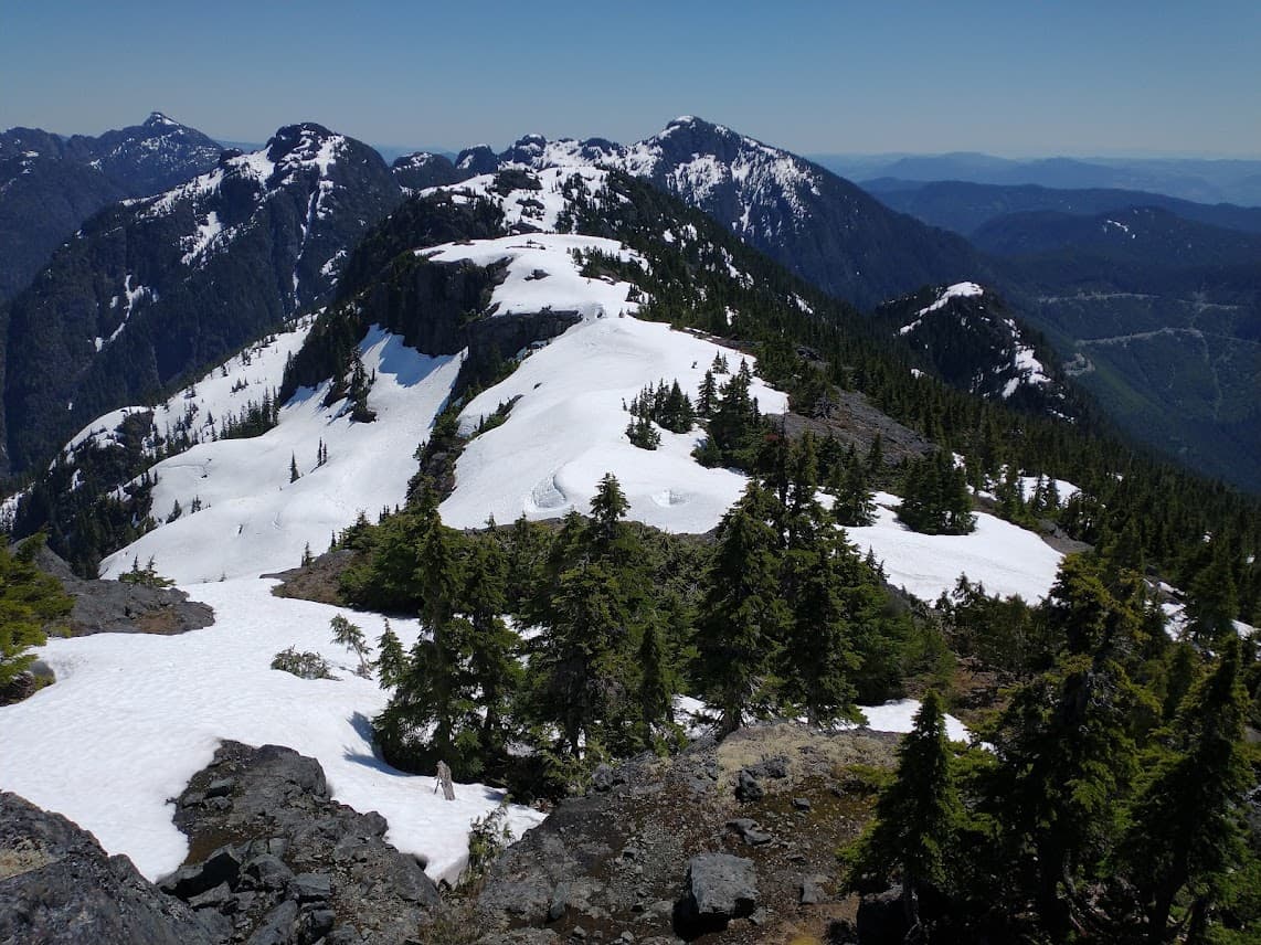
Mount Service, with our route approximately in the centre of the picture
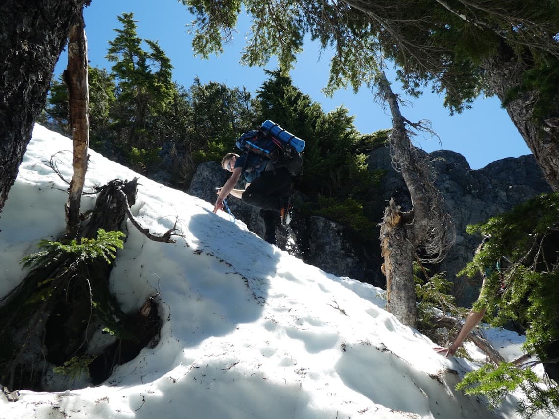
It took us considerable patience and focus to frequently switch between steep snow, ice, rock, and vegetation. But this still seemed preferable to the wide swaths of steep and icy snow further to the left. Things got exciting when we climbed to the base of a small cliff, with steep snow and a bergschrund right below, blocking our upward progress. Fortunately, a stunted tree at the top of the cliff was within reach and provided a green belay, once the branches were vigorously pushed out of the way. After we all found slightly different ways up, through or around the tree, none of them aesthetically too pleasing, the hike to the summit was straightforward. Much of the route from hereon was on flat and firm snow, which was welcome at this point of the trip.
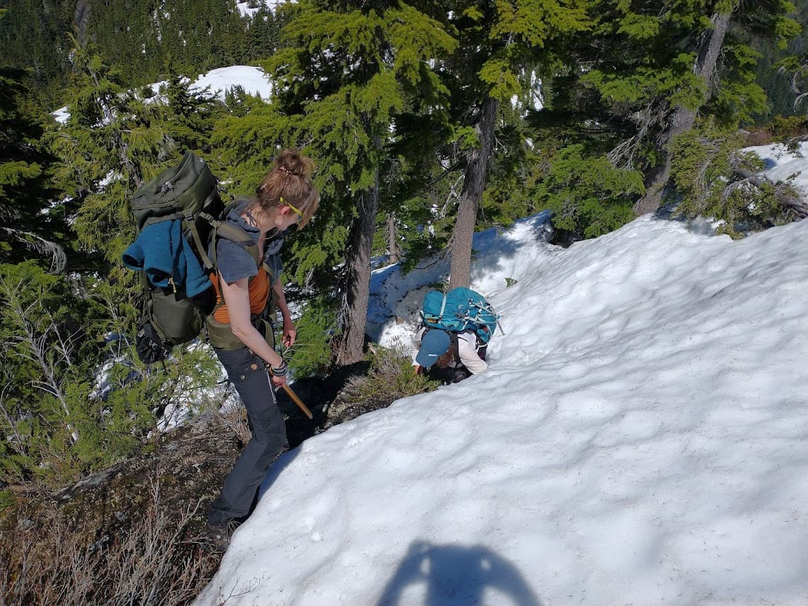
One of the transitions from snow to rock
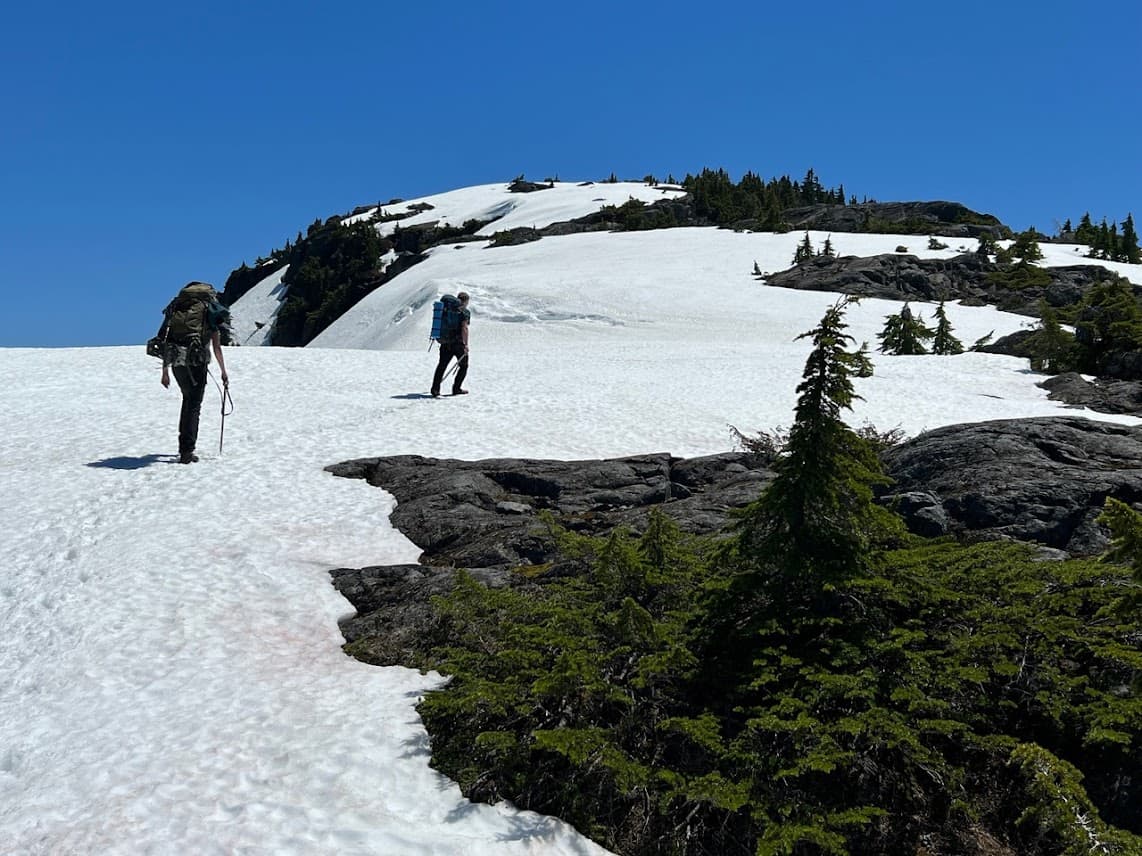
Back on the snow (photo credit: Catrin)
However, the wide and open ridge traverse eventually leads to a nameless bump that is almost as steep and challenging as Mt Service. We were forced to repeat the same strategy that we previously used to climb Mt Service, frequently switching between snow, ice, rock, and vegetation along the way, but avoiding the bergschrunds on what would have been the direct route. With the last bump of the ridge finally behind us, the descent through the steep forest to the col between My Service and El Capitan went without a glitch, despite the challenges posed by small cliffs which seemed to appear out of nowhere on the way to the col.
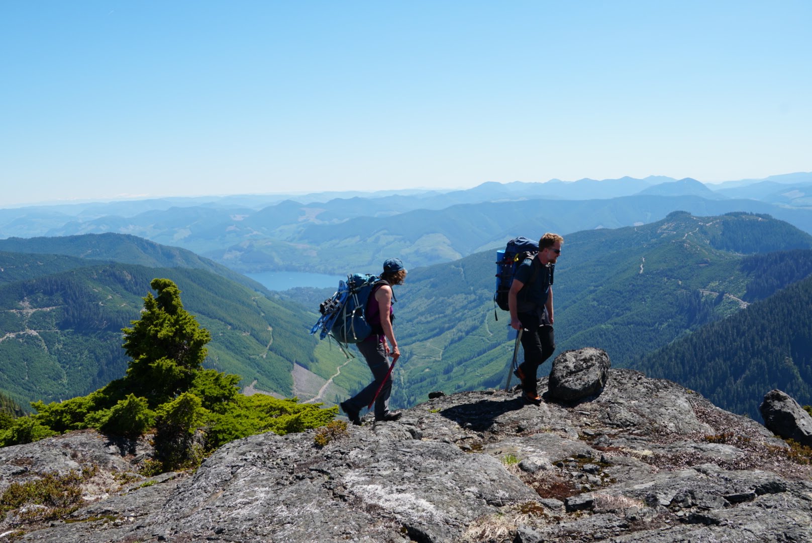
The ridge somewhere near the summit of Mt Service (photo credit: Catrin)
At the summit (photo credit: Adriana)
View from the ridge towards El Capitan (left) and Landale (right)
The second and final bump (photo credit: Adriana)
After the hike back from the col on the Lomas Lake trail back to the Cottonwood Creek camp, and collecting the camping gear, we eventually arrived back at the trailhead, just when it got dark, after 15 hours and 21 km of hiking, exhausted and thankful for a safe and adventurous trip.